As some of you might know, Ian and I set out for a ten-day
trip around the South Island of New Zealand.
The Maori name for the South Island is
Te Wai Pounamu, or “The
Greenstone Waters,” for the type of Jade found in rivers there.
(I chose the Maori name to complement my
prediction that Ian will make a blog post titled “The South Island.”)
Starting on March 5th, we flew into Queenstown,
drove through Te Anau to Milford Sound and back, then headed up along the West
Coast via Fox Glacier and Greymouth before going through Christchurch and back
to Queenstown by the morning of March 14th. And we made it!
 |
| Here's a map, edited professionally by me on Paint, so you can follow along. |
Meanwhile, our linguistics class was scheduled so bizarrely
as to land us with a 20-page paper due March 8
th, even though the
program was officially over.
Ian and I
knew we had to strategically time our stays in hostels to give us enough access
to power outlets and internet to write and turn in our papers on time from
rural New Zealand.
Queenstown
 |
| The center of Queenstown. |
So you know when you take a nice, crisp, brown leaf from the
ground in autumn?
And you crush it in
your hand, feeling all the little pieces poke into your hand before falling
apart?
Well, that’s what I did with the
type-A part of my personality.
We booked
our plane flights and a car beforehand.
That was it.
We didn’t even have
a place to stay when we flew into Queenstown.
Fortunately we met a friend, soon close enough to us to seem a lifelong
pal.
It was a red Hyundai Getz.
Her name is Shmabel.
 |
| I love her. |
Our first evening in Queenstown was a bit of a
scramble.
Adding to this was my
continual distraction by the huge mountains surrounding the town.
 |
| How does is do that? |
Our first stop was groceries, planned to optimize calorie
intake per dollar while minimizing cooking and perishability. Such a grocery list looks like this:
~ carrots
~ capsicum
~ apples
~ kiwi
~ hummus (four flavors!)
~ water
~ muesli (three flavors!)
~ banana chips
~ dried mango
~ trail mix
~ “Budget” brand “snacking crackers”
~ crunchy peanut butter
~ yam cookies
~ crab-shaped crab-flavored snacks
~ beef jerky
~ hazelnut and hokey-pokey chocolate bars
~ lemon biscuits
Breakfast was usually fruit and muesli, lunch vegetables
dipped in hummus, and dinner crackers with peanut butter, supplemented by dried
fruit or trail mix. A feast of kings,
truly. You’ll notice that we were very
close to being vegetarians. Dessert was
whenever. We soon realized, though, that
Shmabel gets a little heated when left untended, and so chocolate-eating became
a morning ritual in which we examined how much the bar still resembled a bar.
After buying food, we needed to get a room for the night to
work on papers. Probably naïvely, we simply drove to
different places and asked if they had room for the night. (Drove awkwardly, I might add, as we were
getting a feel for the left-hand side of the road.) The third place had room at, well, the best
price we were going to get.
We spent the evening wandering the beach and the idyllic
town gardens. Fergburger, the best-known
restaurant in the area, beckoned to us with its greasy, lamby scent. (Photo in upcoming food porn post!) In the evening, it was time for…writing papers.
 |
| A scenic lake, a scenic drake. |
 |
| I've always been fond of trees that defy the vertical. This one, aptly, is a Horizontal Elm. |
The next day we hiked up the Queenstown Hill trail, leaving
us wondrously alone amid mountains.
 |
| A numinous array of cairns on the way up. (Intentionally taken blurrily, a la Blair Witch?) We made a cairn of our own as well. |
 |
| Quails! |
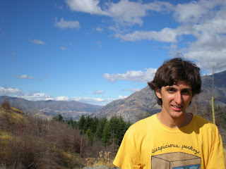 |
| A rare moment in which Ian lets his guard down so I can take an unironic picture of him. |
 |
| !!!! |
 |
| Me, imitating the quails. |
Then, it was a less epic journey to the Queenstown library
to work on papers some more.
A
serendipitous find: Maori dictionaries on shelf!
Te Anau
After leaving the library, we began the drive west to Te
Anau, really just hoping there would be internet there so we could finish and
turn in our papers (you can tell I’m a little bit bitter about this
paper).
 |
| Though it was getting dark, we still had some magnificent views along Lake Wakatipu. |
 |
| And this sunset from where we decided to stop for the night. |
This was our first night of what is called “freedom
camping,” meaning, “sleeping in your car and thus not paying locals for
accomodation.”
The locals are fine with
it if it’s at a campsite, but if it’s just on the side of the road, apparently
they might come at you with axes.
At
least according to one of our classmate’s host family.
Thankfully we did not learn this until after
our last bout of freedom camping, or we may never have slept those nights.
The next day, we hiked a few hours along the Kepler Track,
along Lake Te Anau. There were expansive
stone beaches and a nature reserve along the way.
 |
| Two takahe feeding, with a pukeko in the background. |
 |
| Among the moss-laden trees. |
 |
| Pondering infinity. |
That night we stayed in a pretty decent hostel. We made a noodle dish with chicken,
vegetables, ramen noodles, and curry paste, and then stayed up late finally
finishing our papers.
Milford Sound
Milford Sound is up in the Fiordlands, down a windy (in both
senses) two-hour drive down mountain roads.
At times, I was tempted to grab Ian’s hand across from me and drive us
off the edge to our Thelmic end.
 |
| Say, hereabouts. |
Fortunately/unfortunately, I restrained myself.
There was a tunnel at one point, where you could see kea, a
type of parrot, hanging around and trying to get into parked camper vans.
There are signs everywhere saying DO NOT FEED
THE KEA, as apparently they don’t learn to feed themselves if they get fed when
younger.
 |
| I stalked a kea for this paparazzi shot. |
 |
| The end of the line: Milford Sound. |
The mountains, as I am led to believe, are eternally hung
with mist. Since the tide was low, you
can see the shoreline extending from the path.
Ian and I walked along this for over two hours, enjoying the views while
avoiding muddy patches and sandflies. No
one else was there, so our time at popular Milford Sound was pleasantly
isolated.
On the way back, we stopped at a few hiking tracks. Our favorite was the one up to Lake
Marian. We didn’t make it all the way
there, because it was getting dark, but we got to see the falls.
 |
| Mutual picture-taking on a precarious swingbridge. |
 |
| The river. |
 |
| Ian monkily scampered off the path to scare with this. |
 |
| At the Mirror Lakes, we caught the sun just as it touched the tip of a mountain. |
The rest of our time in the Fiordlands was spent scampering
among the grassy fields.
As I expressed
to Ian, I have had a deep need to run through waist-high golden fields,
probably born from drives through northern Minnesota spent longingly looking
through the window at all the land other people own.
Finally this need was fulfilled.
 |
| You'll remember me when the west wind moves...among the fields of barley... |
The Glaciers
Day 5 was primarily a driving day, all the way from the
Fiordlands south, east, and north to the glacier area.
 |
| Many lakes, many mountains. |
 |
| Oh, and Fantail Falls. The fantail is a favorite native New Zealand bird. |
 |
| And also...this. (This is the part where we are slaughtered gruesomely yet cleverly in an abandoned barn.) |
It wasn’t until the next day that we got to the glaciers themselves. There are two, actually, Fox Glacier and
Franz Josef Glacier, each with a town named after them. There was some backtracking involved, driving
to Fox Glacier, then to Franz Josef Glacier, then back to Fox Glacier to spend
the night, then back through Franz Josef Glacier again the next day.
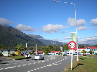 |
| Quaint Fox Glacier. Population: whoever's coming through, plus a few others. |
 |
| Beware both of falling ice and falling rocks! |
 |
| Fox Glacier itself. Though it looks immobile, people have apparently died after climbing over the barriers for a closer look. |
 |
| Meltwaterfalls at Franz Josef Glacier. |
 |
| As Ian pointed out, Franz Josef Glacier resembles an elephant head. |
The glacier areas are peculiar in being decidedly
tropical up until the ice itself, when suddenly, a huge mass of frozen water that
apparently doesn’t all melt away. For
example, this path.
 |
| Minnesota people, I have no explanation for why this path is called Minnehaha, though I searched. Some distant relation to Minnehaha Falls? Are they antipodes? |
Fox Glacier is also home to Lake Matheson, a well-known
“mirror lake” that becomes almost absolutely still near dawn and dusk. We set out from our campsite at 5:45 a.m. to
catch it at its most still, though there wasn’t light enough yet to see it.
 |
| An interesting effect was achieved, as Ian discovered, by lying down on the dock with your head hanging upside-down over the edge. It looked as if the lake was a dense, suspended sky, and the lake a mass of air beneath it. |
 |
| And now I'm just messing around. |
 |
| I call it "Pukeko Dawn" |
The West Coast
Another travel day was Day 7, but with beautiful stops along
the way. The West Coast of the South
Island surprises with expansive beaches and odd stone structures.
 |
| And also this sock machine museum in Hokitika. |
 |
| I didn't even know there was such a thing as a sock machine. |
The map promised a town of Karoro, which happens to be one
of we ling kids’ favorite Maori words: seagull.
There was no sign, but we managed to find Karoro Domain, which was
basically an empty lot with a big beach beside it. There was indeed a seagull there.
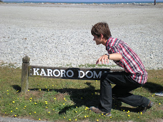 |
| Embodying Karoro. |
 |
| Plus the expansive and disturbingly regular Karoro Cemetery, not actually home to deceased karoro. I have an affinity for cemeteries. The more hills, the more lichen, the more broken tombstones, the more at home I feel. The parallelism of this one, though, left me a little creeped out. |
At Punakaiki we saw the Pancake Rocks, which are formed by
an unclear process involving layers of limestone with weaker layers of mudstone
between that erode more easily. They
stick up out of the shore in odd shapes, almost with sentience.
 |
| We heard this one old man walk by grumbling, "Just more water and rocks..." I could not help it. I burst out laughing right next to him. |
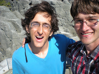 |
| Pancake rock selfie! |
Just north of the pancake rocks, we found the nearly
unmarked Punakaiki Cavern. You could
just, you know, go in and walk around.
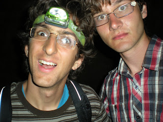
Luckily Ian had his headlamp, otherwise we would have gotten nowhere.
 |
| There were, I think, three guideposts to help you. |
 |
| Pointless cave selfie! Because you can't see anything behind us anyway! |
 |
| *~spelunking desu~* V(^-^)V |
Then we found a long beach quite suited for a long walk
beside it.
 |
| Rock structures we of course climbed and frolicked among. |
 |
| We went even past that rock in the distance. |
 |
| Success! |
 |
| Impromptu drift-material sculpture we stumbled upon. |
This was probably our worst night sleeping-wise,
though.
Our chosen spot was on the other
side of the road from a railway, almost under a bridge, and by a sign that
warned of the poison nearby used to kill stoats.
Christchurch
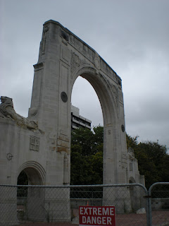
As some of you might now, Christchurch was hit with an
earthquake in 2011 that basically destroyed the city. (As I mentioned in a prevois post, New
Zealanders have had to do without their beloved Christchurch-made Marmite,
though the grand re-release is in just three days!) The trouble with rebuilding a city, though,
is that it still needs to operate while the rebuilding is happening, and so the
construction takes longer and is also right in the center of the public gaze.
I found a currency exchange place on Google Maps, even saw
it on the street view, but when I walked to it, found it was right in the “Red
Zone,” where the roads are closed and the buildings are deserted or being
rebuilt.
 |
| The Bridge of Remembrance, built to honor war heroes, now might stand as a memento of tragedy at home as well. |
The overall impression I got of Christchurch was “industrial
dystopia,” which I feel bad for thinking.
I blame this partially on the weather, though, which was overcast,
chilly, and damp. Because I was only
there for one day, I associated the temporary weather conditions with
Christchurch’s permanent state. At
times, though, there’s a neat recycled aesthetic to the city. There’s a mall where each store is housed in a
repurposed shipping container. Certain
craft shops are fond of steampunk, maybe for the idea of discovering beauty in
ruined or unusable things.
 |
| The Dance-O-Mat. An old washing machine you can hook an iPod up to, with a stage and disco ball to boot. |
 |
| At the ReBuild shipping container mall. |
 |
| The actually quite beautiful botanic gardens. Every so often a punter will go by down the Avon River (usually with Asian tourists). |
 |
| A fitting feature for an urban garden: a statue of a plant. Also, how could I not include this picture? |
 |
| Another day we encounter a sundial and it's cloudy. |
 |
| A typical scene from the city center. |
Queenstown
The drive back to Queenstown was not super eventful. It was mostly non-stop, and thus filled with
poor pictures taken from the car, which I will spare you.
 |
| Except this one, of a mountain with patches of cloud-shadow. |
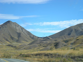
Many vineyards, many hills, many cows revelling in their
bovinity.
 |
| These looked as if they were piles of dirt that might wash away in the rain. |
Oh, one eventful thing!
Ian ran over a hawk. Just outside
Maryburn, we saw some roadkill, then noticed it was actually something feeding
on roadkill. Ian was considering
swerving, but I coldly told him, “No, you have to keep going.” We assumed it would fly away, but it only
looked up pitifully at the last second as if to say either, “I understand,” or
“Man, shit.” We heard a thunk. Behind us, I saw a cartoonish cloud of white
feathers floating above the highway.
Only one piece of evidence remained on the car by Queenstown.
 |
| A murder most fowl. |
I patua te kāhū e tō māua waka whero nohinohi.
In Queenstown, we had a relaxed evening of ice cream and
watching the parasailers glide in.
 |
| Graceful... |
 |
| ...as the ducks and seagulls everywhere. |
 |
| We camped our final night at Twelve Mile Delta, apparently the site used as the set for Ithilien Camp in the Lord of the Rings movies. Not that I would know. Maybe you'll recognize it, if you pretend it's not dark and there aren't camper vans all over. |
In the morning, we finished off our food, packed up our
stuff properly, and went to the airport to say our final goodbye to Shmabel. And thus, we parted with the South Island,
knowing we had seen something approaching most of it. A grand Kiwi Vagabond Week it was.


First thought: how did you guys manage to keep so clean-looking?!?!?!?!?!
ReplyDeleteSecond thought: DAMN Aotearoa, you pretty.
Third thought:Post more.